Understanding Prachovské Skály Formations
Learn how sandstone towers formed millions of years ago and what makes the rock formations in this area geologically significant.
Understand the ancient geological forces that shaped Bohemian Paradise’s distinctive sandstone formations. Learn to read the rocks, recognize different strata, and appreciate the millions of years of natural history beneath your feet on every trail.
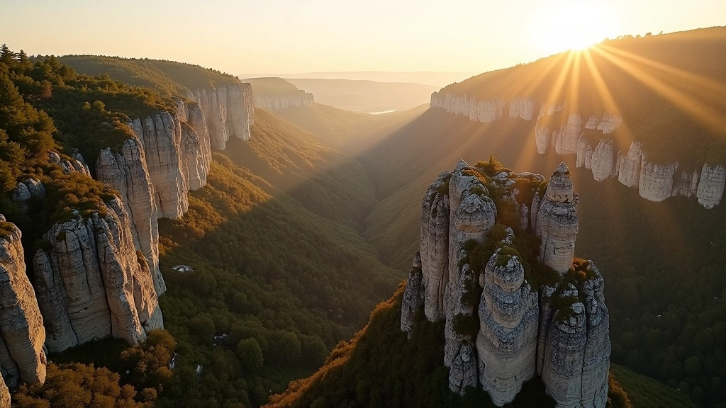
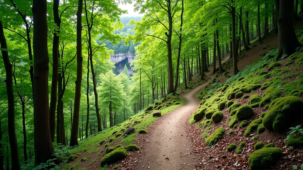
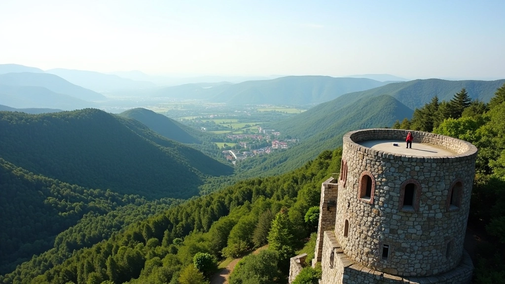
Walking through Bohemian Paradise isn’t just a hike — it’s a journey through 100 million years of Earth’s history. The sandstone towers you’ll encounter aren’t random rock formations. They’re carefully preserved chapters of ancient seabeds, deserts, and river deltas that tell the story of how this region transformed over millennia.
We’re going to teach you how to read these rocks like a book. You’ll learn why the cliffs are layered, what those layers tell us, and how water carved these dramatic formations into the shapes you see today. By the end of this guide, you’ll see every trail differently.
Let’s start at the beginning. About 100 million years ago, this entire region was covered by a warm, shallow sea. Sand from river deltas and coastal erosion accumulated on the seabed, layer after layer. Over time — we’re talking tens of millions of years — the weight of all that material pressed down on the lower layers, compacting them. Water containing minerals seeped through, and the sand grains got cemented together with silica. That’s how sandstone forms.
But here’s what makes Bohemian Paradise unique: the sandstone here isn’t uniform. You’ll see variations in grain size, color, and hardness. These differences matter. Coarser sand creates softer rock that erodes faster. Fine-grained sand makes harder stone that resists weathering. This variation is why you get those dramatic towers and deep canyons — different layers erode at different rates, creating the complex topography you see today.
Water is the sculptor. Rain seeps into cracks, freezes in winter, and expands. Tiny fractures grow bigger. Over thousands of years, streams carve valleys. The result? The incredible landscape you’re hiking through now.
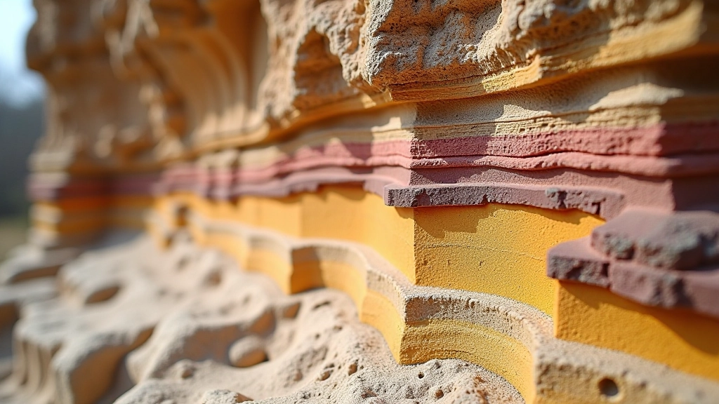
Each layer represents a different time period and different environmental conditions. Learning to spot these layers transforms a casual walk into an actual geological investigation.
Lighter in color, erodes most easily. Forms slopes and rounded features. Often covered with vegetation because it holds moisture better.
Darker, harder sandstone with larger grain size. Resists erosion and forms cliff faces and tower bases. This is the real strength of the formation.
Variable composition, shows evidence of changing ancient conditions. Contains different mineral content. Acts as a transition between upper and basal layers.
The foundation. Very hard, iron-rich sandstone. You’ll rarely see this exposed unless you’re at the base of major cuts or gorges.
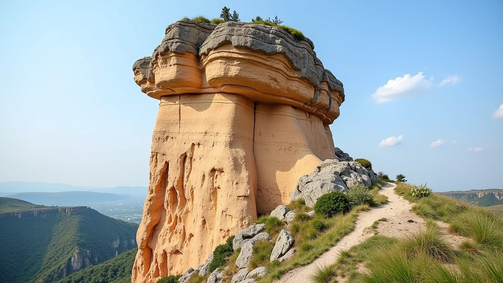
Not all sandstone erodes at the same rate. This differential erosion is what creates the dramatic relief you see in Bohemian Paradise. Here’s what happens: water finds the weakest point — usually where layers meet or where there’s a natural joint in the rock. It exploits that weakness relentlessly. Over millennia, a tiny crack becomes a narrow gorge. A slightly softer layer erodes back faster than harder rock above it, creating overhangs and towers.
Key observation: Look for horizontal notches in cliff faces. These mark the boundary between hard and soft layers. The soft layer underneath eroded faster, undercutting the harder rock above. This is exactly how natural arches and overhangs form.
The towers you see — places like Drkolová Věž or the formations around Prachovské Skály — exist because they’re made of the harder middle layer. The surrounding softer rock eroded away, leaving these pillars standing. They’re not immune to erosion though. They’re just eroding more slowly. Given another 50,000 years, even these towers will eventually fall.
You don’t need a geology degree to read the rocks. Here are the practical features you can actually observe while hiking:
Run your hand along the rock (carefully — sharp edges!). Coarse-grained sandstone feels grainy and rough. Fine-grained is smoother. Coarse grain usually means softer rock and faster erosion.
Light tan or beige is typical, but you’ll see variations. Darker bands indicate iron-rich layers. Reddish tones mean iron oxide. These color differences tell you about ancient water conditions.
Look for differential weathering — some surfaces are smooth, others pitted. Pitting indicates softer, more easily eroded material. Smooth surfaces are harder rock that resists weathering.
Natural fractures run through the rock in predictable patterns — usually vertical or nearly vertical. Water follows these joints, widening them into cracks and eventually canyons.
This guide presents geological information for educational purposes to enhance your appreciation of Bohemian Paradise’s natural landscape. While we’ve worked to ensure accuracy, geological knowledge evolves. For detailed scientific analysis or specific geological questions, we recommend consulting with certified geologists or academic resources. Always follow local hiking regulations, respect trail closures, and prioritize safety when exploring these formations.
Now you understand the story written in stone. Every cliff face, every tower, every canyon has a geological narrative. The rocks beneath your feet aren’t just pretty scenery — they’re a 100-million-year record of ancient seas, deserts, and endless patient erosion.
On your next walk through Bohemian Paradise, take time to really look. Notice the layers. Feel the different textures. Follow the water flow and imagine the millennia of carving that created each valley. You’re not just hiking through a landscape — you’re reading a geological masterpiece.
Ready to explore more about Bohemian Paradise?
Browse All Hiking Guides